data set
raster data
- ReadyMap.org - Free online 15m image, elevation tile data
- NASA BlueMarble - NASA Global Images, including Topography and Oceans
Elevation data
- ETOPO1 - A global topographic relief model with 1-arc resolution, which contains data on terrain and ocean water depth
- SRTM - Global 250m Elevation
vector data
- OpenStreetMap - Globally, street and land data maintained by open source communities (vector and raster data)
Other data sets
- http://docs.osgearth.org/en/latest/data.html
- http://vterrain.org/Imagery/WholeEarth/
- https://grasswiki.osgeo.org/wiki/Global_datasets
data processing
Construction of projection coordinates
Some of the map data downloaded online are not projected coordinate information, or other coordinate systems (such as UTM), we can use commonly used GIS tools to modify. Here the elevation data of ETOPO1 is used to demonstrate:
Open the ETOPO1_Ice_g_geotiff.tif file using Global Mapper 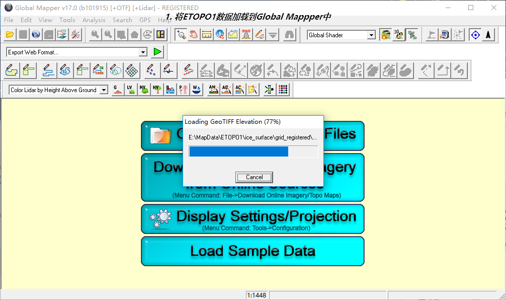
Setting projection parameters, Projection: Geographic (Latitude/Longitude), Datum: WGS84, Panar Units: ARC DEGREES 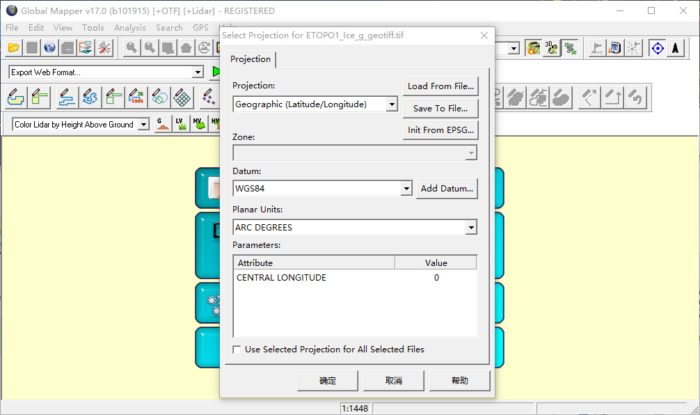
After loading, it chooses to export to the elevation grid format - > GeoTIFF. The derived parameters can be used by default. After exporting, the GeoTiff elevation data are processed by projection coordinates. 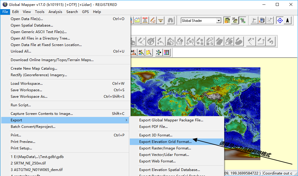
VPB Data Page Data Making
VPB data pages are produced using osgdem tools, using the elevations of NASA images BlueMarble and ETOP1 as examples.
osgdem.exe --bluemarble-west -t E:\MapData\NASA\land_shallow_topo_west.tif --bluemarble-east -t E:\MapData\NASA\land_shallow_topo_east.tif -d E:\MapData\SRTM\SRTM_W_250m_TIF\SRTM_W_250m.tif -d E:\MapData\SRTM\SRTM_SE_250m_TIF\SRTM_SE_250m.tif -d E:\MapData\ETOPO1\ETOPO1_Ice_g_geotiff.tif terrain --geocentric -l 10 -o E:\MapData\ETOPO1\earth.iveosgdem parameter description:
osgdem.exe --help
Usage: osgdem [options] filename ...
Options:
--HEIGHT_FIELD Create elevation data
--LOD EstablishLODdata
--POLYGONAL Create elevation data field database
--PagedLOD EstablishLODData Page
--RGB-16 16bit image
--RGB-24 24bit image
--comment Add a comment to the file that fires at the top to describe what
--compressed UseOpenGLCompressed image
--cs To set up the coordinate system, the string must be formatted correctly.(GDAL/OGR forms, complete WKT, PROJ.4,EPS)

--max-anisotropy Define the texture display level by default1.0
--max-visible-distance-of-top-level Setting maximum visual distance
--mip-mapping-hardware Use mipmaps,Guarantee that there are corresponding data in the designated location.
--mip-mapping-imagery Use mipmaps,And it is generated in the image. mipmaps .
--no-mip-mapping Do not use texture mipmaps.
--radius-to-max-visible-distance-ratio Set the maximum visual distance ratio.
--skirt-ratio Setting Edge Ratio
--tile-image-size Set the Size of a Single Picture
--tile-terrain-size Setting Size of Single Terrain
--wkt For pictures or dem System for setting coordinates(in WellKownText form.)
--wkt-file File to complete the above operation
-d Elevation maps to be processed
-e Generated model size range
-h or --help Demonstration Help Information
-l Set upLODGrade
-m Set up the model file to be processed
-o Set the output model file
-t Specifies the texture file to be processed
-v Setting vertical growth rate
osgdem can use patch functions to build local high-definition data, such as:
osgdem.exe --patch F:/VPB/out.ive -t ./Texture/1.tif -t ./Texture/2.tif -t ./Texture/3.tif -t ./Texture/4.tifIn osgEarth, use VPB driver to load ive tile data, vpb.earth file:
<!--
osgEarth Sample - GDAL Driver
Demonstrates the simplest possible use of the GDAL driver to load a GeoTIFF image.
-->
<map version="2">
    <image name="imagery" driver="vpb">
        <url>srtm.ive</url>
    </image>
    <heightfield name="etopo1" driver="vpb">
        <url>srtm.ive</url>
    </heightfield>

    <ocean driver="triton">
        <user>my_user_name</user>
        <license_code>my_license_code</license_code>
        <max_altitude>50000</max_altitude>
    </ocean>
    <options>
        <lighting>false</lighting>
    </options>
</map>
Making TMS tiles with osgearth_package
Command line:
osgearth_package.exe --tms E:\MapData\ETOPO1\ice_surface\grid_registered\etopo1_g.earth --max-level 10 --ext tif --out E:\MapData\ETOPO1\etopo1_g.earth file:
<map name="ETOPO1" version="2">
  <heightfield name = "etopo1_g" driver = "gdal"> // The directory name of the final data is etopo1_g
        <url>ETOPO1_Ice_g_geotiff_reprojected.tif</url>
  </heightfield>
</map>
Description of commonly used parameters for osgearth_package:
- tms: After the cutting is completed, tms.xml is generated for the publication of tms.
- max-level 20: What is the highest cutting level? The highest cutting level is described here, i.e. 0-19.
out: The generated result store path.
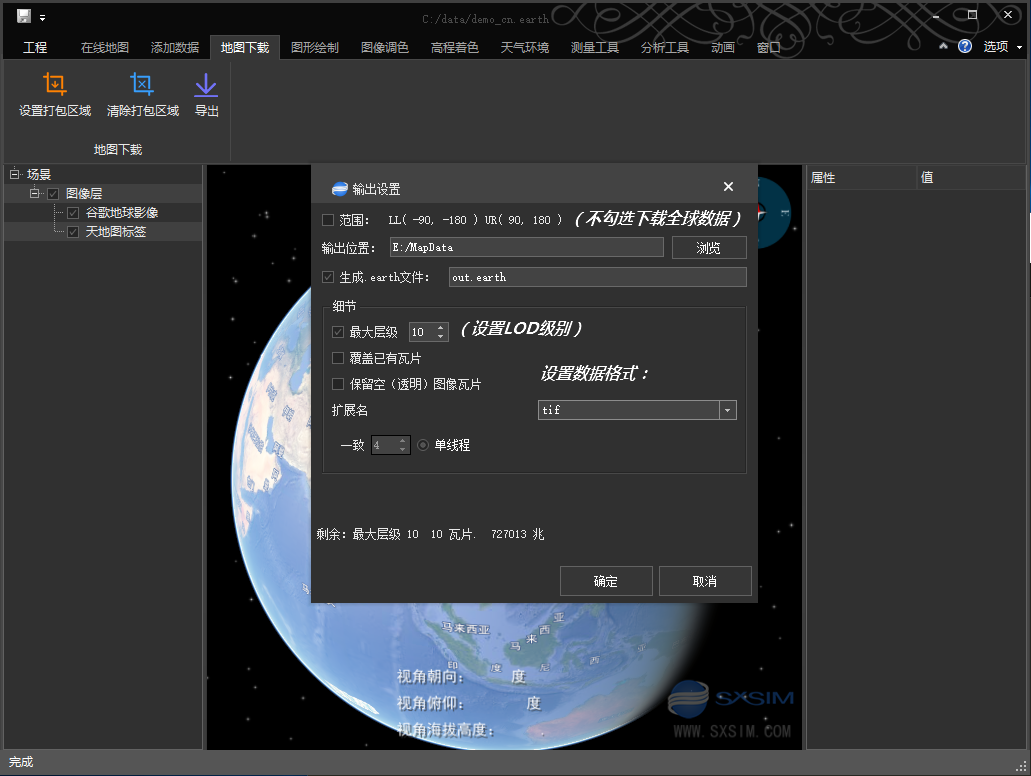
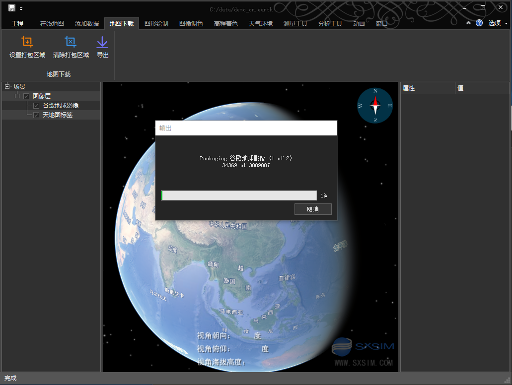
Download free map data using SxEarth
reach SxEarth Official website download the latest version of the client 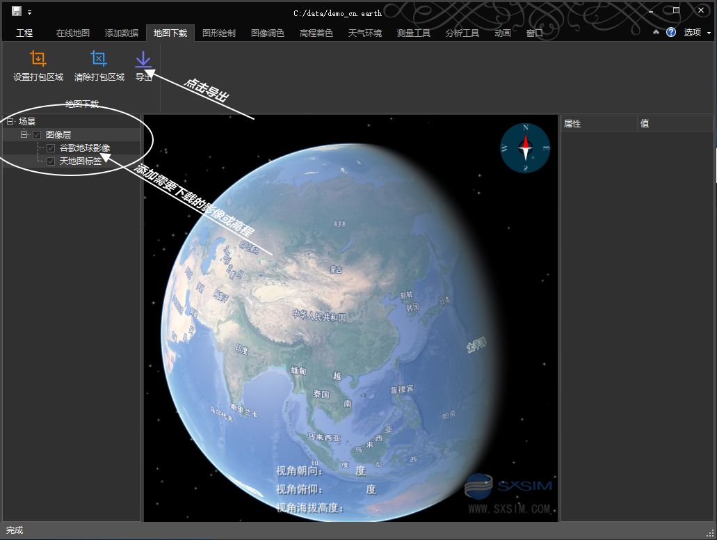
Deployment of tile services
Deployment of TMS tile service using HTTP server
The TMS tiles service only needs to enable directory browsing and MIME type (tiles service can also be implemented by sharing files in Windows). Here, IIS example is used:
Create a website and bind it to a map data folder 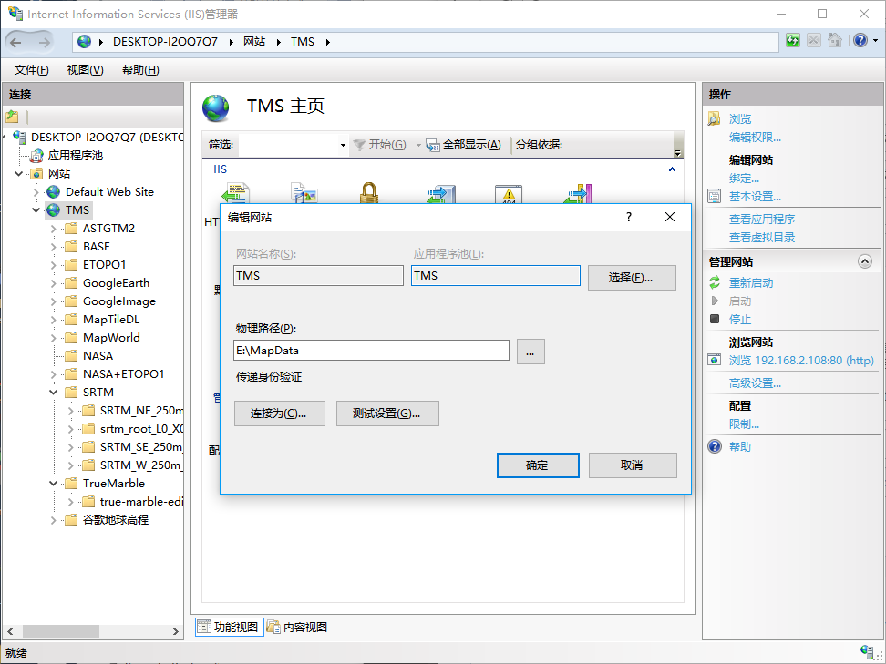
Set up directory browsing, click Enable 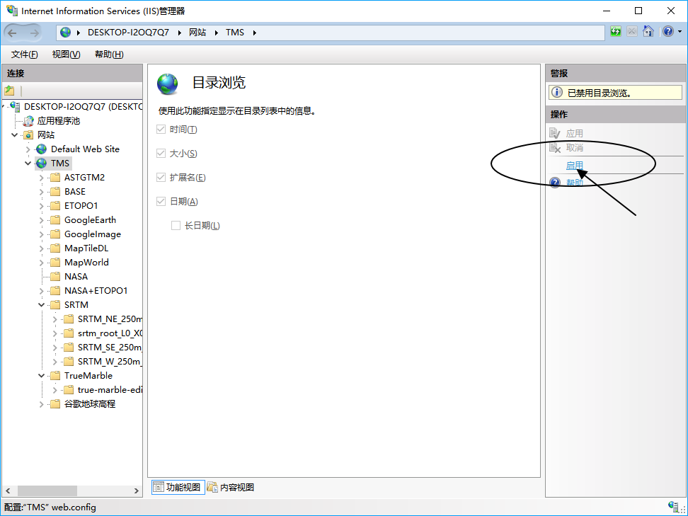
Set MIME type and add.* 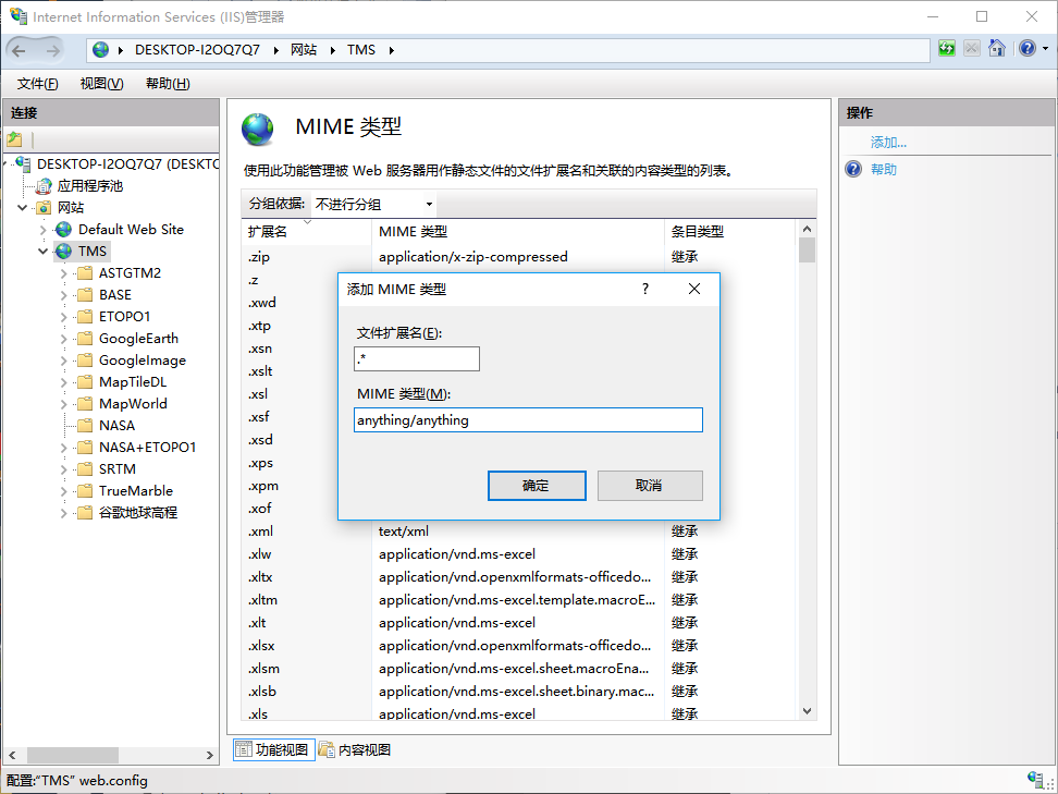
When you add an image or elevation/heightfield tag to the. earth file, just fill in the image or high-level tms.xml URL path in the url.
<image name="googleearth" enabled="true" min_level="4"  driver="tms">
    <url>http://127.0.0.1/MapData/GoogleEarth/tms.xml</url>
</image>