Preface
When we use the ArcGIS JS API, we will encounter entering a name in the text box, querying the element, and realizing the function of finding the element.
Get ready
- Deploy ArcGIS JS API locally / call online API
- Publish a good dynamic map service
thinking
- HTML page textbox receive query name
- Click event to trigger findTask query in API
- Instantiate findTask parameter FindParameters and set
- Instantiate the FindTask parameter and call the execute function
- Highlight the obtained feature positioning
- New graphic symbol in callback function
- Set get findTask query get geometry
- Obtain the coordinates of the center point and locate it
- Display information in the table panel
- Using array to get query information
- Show information in table
code implementation
<!DOCTYPE html>
<html lang="en">
<head>
    <meta charset="UTF-8">
    <title>Hello World</title>
    <link rel="stylesheet" type="text/css" href="http://localhost:8080/arcgis_js_api/library/3.20/3.20/dijit/themes/tundra/tundra.css"/>
    <link rel="stylesheet" type="text/css" href="http://localhost:8080/arcgis_js_api/library/3.20/3.20/esri/css/esri.css" />
    <script type="text/javascript" src="http://localhost:8080/arcgis_js_api/library/3.20/3.20/init.js"></script>
    <style>
        *{
            padding: 0px;
            margin:0px;
        }
        table{
            margin-top: 10px;
            border-collapse: collapse;
            overflow-y: scroll;
        }
        th,td{
            padding: 0px;
            border:1px solid #000;
        }
    </style>
</head>
<body class="tundra">
    <div id="mapDiv" style="width:calc(100% - 2px); height:800px; border:1px solid #000;"></div>
    Name:<input id="searchInput" type="text">
    <input id="btn" type="button" value="query">
    <table >
        <thead>
            <tr>
                <th width="100px">Name</th>
                <th width="100px">type</th>
                <th width="100px">The measure of area</th>
            </tr>
        </thead>
        <tbody id="infoBody">
        </tbody>
    </table>
    <script>
    require(["esri/map",
            "dojo/query",
            "dojo/dom",
            "dojo/on",
            "esri/layers/ArcGISDynamicMapServiceLayer",
            "esri/tasks/FindTask",
            "esri/tasks/FindParameters",
            "esri/symbols/SimpleMarkerSymbol",
            "esri/symbols/SimpleLineSymbol",
            "esri/symbols/SimpleFillSymbol",
            "esri/geometry/Point",
            "esri/Color",
            "esri/graphic",
            "dojo/domReady!"],
        function(Map,query,dom,on,ArcGISDynamicMapServiceLayer,FindTask,FindParameters,SimpleMarkerSymbol,
                 SimpleLineSymbol,SimpleFillSymbol,Point,Color,Graphic){
            var nameArr=[];//Used to store query location name
            var shapeArr=[];//Used to store query shape s
            var areaArr=[];//For storage area
            var map = new Map("mapDiv");
            var layer=new ArcGISDynamicMapServiceLayer("http://localhost:6080/arcgis/rest/services/firstTest/firstService/MapServer");
            map.addLayer(layer);
            query("#btn").on("click",function(){
                var name=dom.byId("searchInput").value;//Get the value of the input box
                map.graphics.clear();//Clear graphics
                //Instantiate query parameters
                var findParams = new FindParameters();
                findParams.returnGeometry = true;
                findParams.layerIds = [0,2];//Inquiry on the memory of prefecture level cities and provinces
                findParams.searchFields = ["name"];//Match name attribute in layer
                findParams.searchText = name;
                //Instantiate query object
                var findTask = new FindTask("http://localhost:6080/arcgis/rest/services/firstTest/firstService/MapServer");
                //Query
                findTask.execute(findParams,showFindResult)
            });
            function showFindResult(queryResult)
            {
                //Initialization information staging array
                nameArr=[];
                shapeArr=[];
                areaArr=[];
                if (queryResult.length === 0) {
                    alert("Query no results");
                    return;
                }
                for (var i = 0; i < queryResult.length; i++) {
                    nameArr[i]=queryResult[i].feature.attributes.NAME;
                    shapeArr[i]=queryResult[i].feature.attributes.Shape;
                    areaArr[i]=queryResult[i].feature.attributes.AREA;
                    //Define symbols for highlighted graphics

                    var pointSymbol = new SimpleMarkerSymbol(//Defining point symbols
                        SimpleMarkerSymbol.STYLE_CIRCLE, 10,
                        new SimpleLineSymbol(SimpleLineSymbol.STYLE_SOLID,
                            new Color([255,0,0]), 1),
                        new Color([255,0,0]));
                    var outline= new SimpleLineSymbol(SimpleLineSymbol.STYLE_DASHDOT,new Color([255, 0, 0]), 1); //Defining boundary line symbols for faces
                    var PolygonSymbol = new SimpleFillSymbol(SimpleFillSymbol.STYLE_SOLID, outline,new Color([0, 255, 0, 1])); //Defining face symbols

                    var graphic ={}; //Create graphic
                    var locationPoint ={};//Create anchor point
                    var geometry = queryResult[i].feature.geometry;//Get the shape of the figure
                    if(geometry.type ==="polygon"){
                        graphic = new Graphic(geometry, PolygonSymbol);
                        locationPoint=geometry.getCentroid();
                    }
                    else if(geometry.type ==="point"){
                        graphic = new Graphic(geometry, pointSymbol);
                        locationPoint=geometry;
                    }
                    //Add graph to map
                    map.graphics.add(graphic);
                    map.centerAndZoom(locationPoint,1);
                }
                var html="";
                for(var i=0;i<nameArr.length;i++){
                    html+="<tr>" +
                            " <td >"+nameArr[i]+"</td>" +
                            "<td >"+shapeArr[i]+"</td>" +
                            "<td >"+areaArr[i]+"</td>"+
                        "</tr>";
                }
                dom.byId("infoBody").innerHTML =html;
            }
        })
</script>
</body>
</html>
Operation result
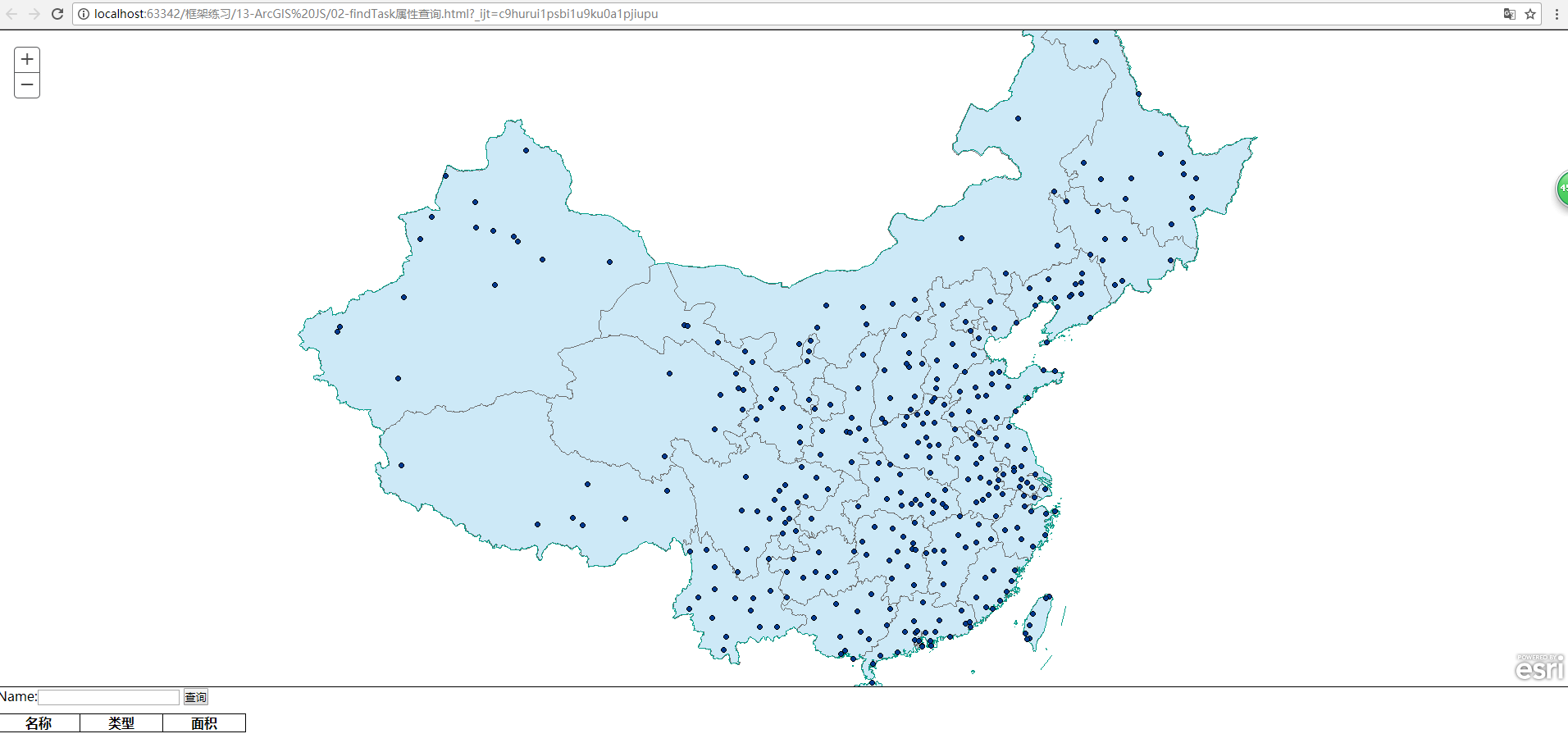
- Before query
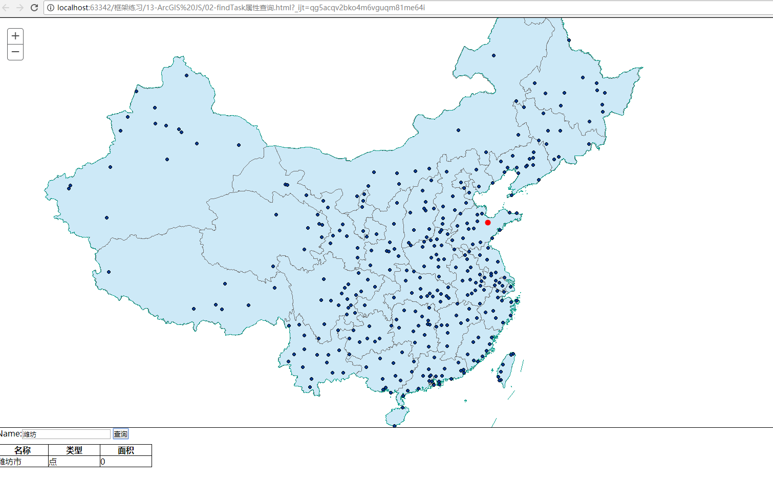
- City query
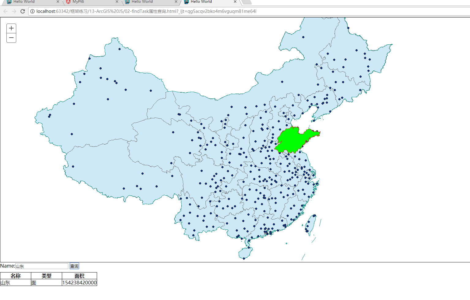
- Provincial query
Pay attention to problems
-
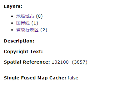
Publish layer service structure